Sport

Hike to the mountain hut Le Mont pourri

Peisey-Vallandry

Hike to the mountain hut Le Mont pourri
mnpc
Description

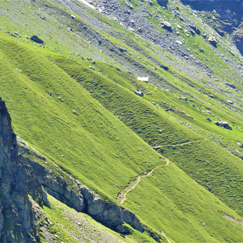
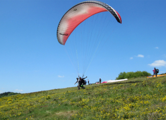
Discover the "real life" of mountain people by talking to the Sévalière alpagistes who will tell you, if you are lucky enough to meet them, some anecdotes about this very special life. And it is surrounded by herds of heifers that you will progress even higher to reach the Mont Pourri refuge where you will have a panoramic view of the north face of Bellecôte and the summits of the Vanoise. From here, a bearded vulture high in the sky is not to be excluded, as well as chamois and ibexes which, like you, will be delighted to refresh themselves by crossing the various nants. It is there that an eco-museum is perched recounting the exploits of the mountaineers of the Peisey valley: a must-see! And a short half-hour detour to the sheep lake is highly recommended as the cotton grass is so beautiful, like an army of small white balls reflected in the clear water.

Guidebook with maps/step-by-step

Topo Beaupraz to the Regaud museum via the Mont Pourri refuge:

Start: Lanches - Beaupraz bridge (1,500 m)

1/ Cross the hamlet. At the entrance to the forest turn right. Pass overhead after the ruins of Loyes (2031 m)

2/ You then cross the Sévolière mountain pasture and turn left. The CAF refuge (2 3070 m) is the starting point for other hikes. Overnight stay is recommended.

3/ Less than an hour's walk from this refuge is the former starting point for the ascent to Mt Pourri: the Regaud refuge (2 460 m). It is a small museum which recounts the history of the assaults. Worth a visit! All around: glacial moraine flora.

4/ From the refuge, head towards the Plagne lake to the Carro ruins (2,200 m).

5/ We find the path that goes straight back north on a balcony above the cliffs. We reach the Lauyes and then go back down to Beaupraz on the path that led up.

Ouverture

All year round.

Subject to favorable weather.

Tarifs

Free access.

Contact et accès
Beaupraz
73210 Peisey-Vallandry
Savoie (73)
Informations complémentaires
Animaux
  • Animaux interdits
À propos de la randonnée
  • Type : Boucle
  • Dénivelé positif : 948 m
  • Altitude Max. : 2370 m
  • Distance : 10.3 Km
  • Length : 5H
  • Niveau de difficulté : Difficle
  • Balisage : oui
  • Balisage : Panneaux Jaunes

Ça peut vous intéresser

Mont Pourri mountain hut (FFCAM)
Laurent Julien

Mont Pourri mountain hut (FFCAM)

Peisey-Nancroix
Col de la Chail - Refuge du Mont Pourri. Musée Regaud. (Boucle)
mnpc

Col de la Chail – Refuge du Mont Pourri. Musée Regaud. (Boucle)

Peisey-Vallandry
À proximité
ascension
Bureau des guides
Sporting activities

Glacier hiking – L’Aiguille Rouge

Peisey-Vallandry
vol ski
Guillaume Desarthe
Service providers

Parapente Addict

Peisey-Vallandry
Chalet Goustin
Office de tourisme de Peisey Vallandry
Bed & breakfast

Chalet Goustin

Peisey-Nancroix
village - visite jeu
Facim S Pérez
Cultural

Visite-jeu en famille : Le sac aux trésors de Félix le montagnard

Peisey-Vallandry
Escape Game Nature
Béatrice Grelaud
Leisure

Escape Game Nature “A la recherche de Tofo le souriceau “

Peisey-Nancroix
Sporting activities

“Bearded Vulture” flight

Peisey-Vallandry
Office de Tourisme Station
Célia Lécuru
Tourism institutions

Tourist Office on the Resort

Peisey-Vallandry
Vue extérieure hiver
Bon Air
Tourist residence

Chalet “Le Bon Air”

Peisey-Nancroix
Le Chalet du Friolin
Alexis Cornu
Restaurant on the ski slopes

Le Chalet du Friolin

Montchavin-les-Coches
piste de ski de fond et piétons
OT Peisey-Vallandry
Cross-country skiing

Nordic area Peisey-Vallandry

Peisey-Vallandry
Skating
ESF Peisey-Vallandry
Service providers

French Ski School in Pont Baudin

Peisey-Vallandry
Chalet
camping les Lanchettes
Campsite

Camping les Lanchettes

Peisey-Vallandry
Sport
Hike to the mountain hut Le Mont pourri

Peisey-Vallandry