Sport

Glacier path

Champagny-en-Vanoise

Description

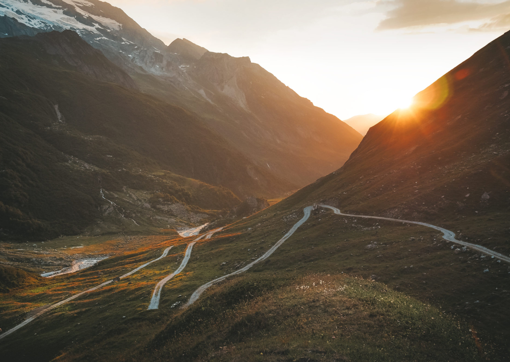
Duration : 4hrs
Distance : 15 km
Positive drop : 810 m
Type : outward and return

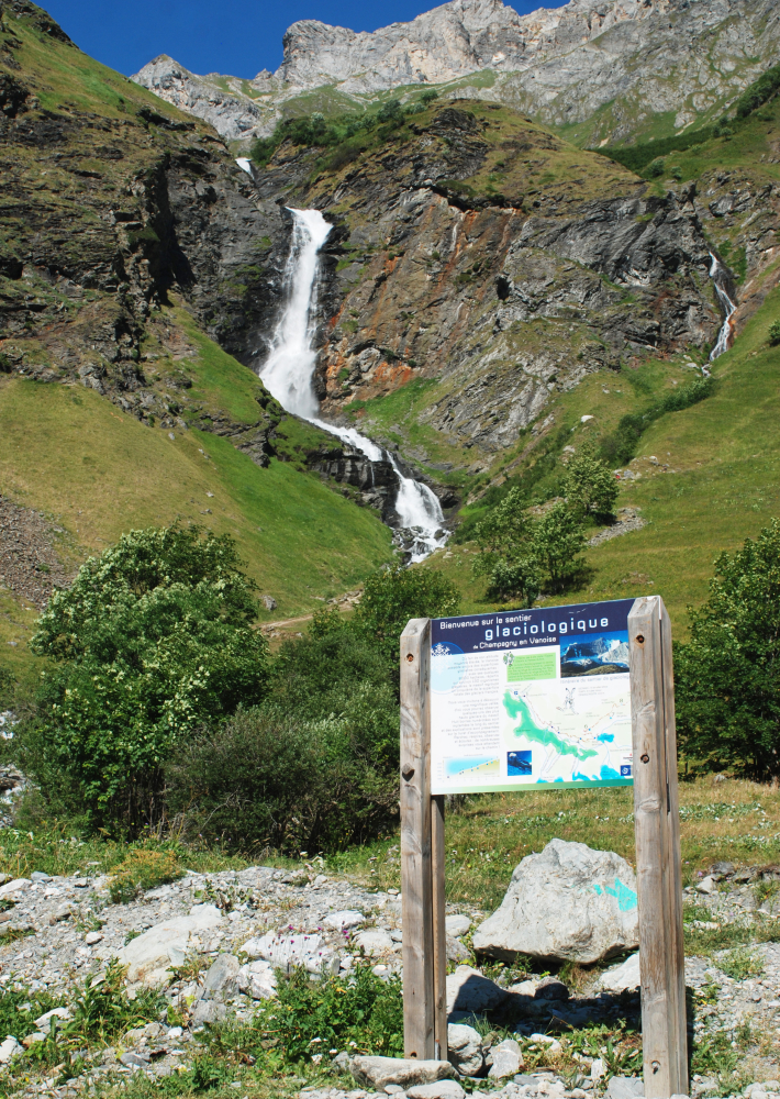
The itinerary, in the heart of the Vanoise National Park, is marked out with 8 numbered milestones which give you a lots of information about the mountain glaciers.

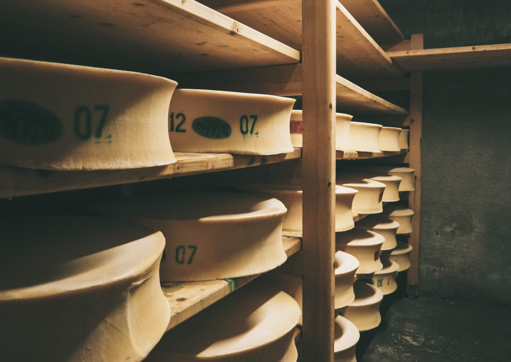
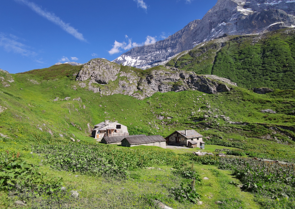
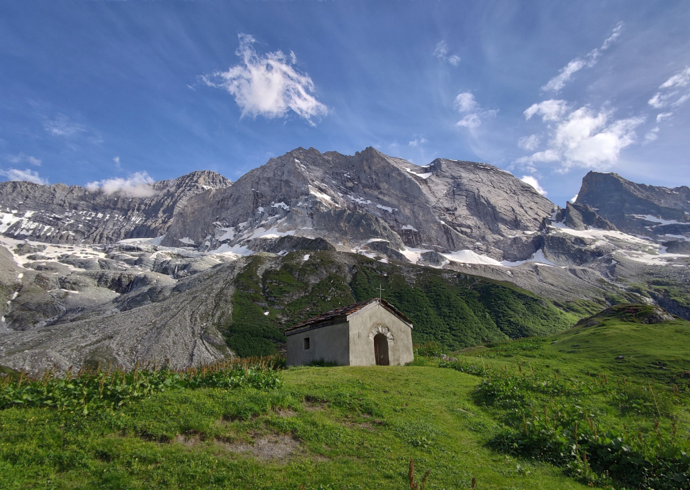
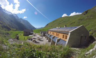
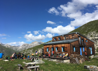
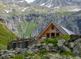
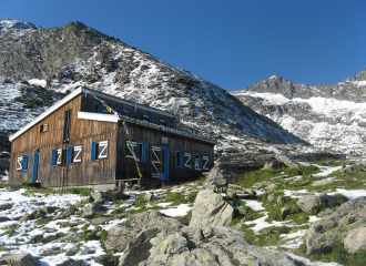
Arrival at the Glière refuge where you can eat (possibility to stay for the night - reservation is required). You continue to the Plan du Sel mountain pasture where Beaufort cheese is made (purchase on site) and where herds of Abondance and Tarines cows graze.

Glière refuge : +33 6 77 08 96 85
contact@refugedelagliere.fr
http://www.refugedelagliere.fr/

Tips

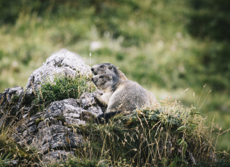
Tip for seeing marmots: prefer cooler times like in the morning or at the end of the day

Guidebook with maps/step-by-step

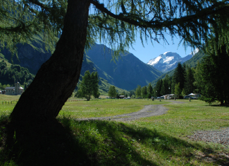
1/ | Point n°1 | From the Laisonnay car park (1560m), take the tarmac road for 300m; after the bridge, first turn left onto the track which then goes to the right, towards the Glière refuge (1996m). | Point n°2, n°3 et n°4 | From time to time, a trail allow you to shortcut. 2/ From the refuge, retrace your steps to get back on the track that climbs to the chapel and the lake. | Point n°5 | On the left, a fairly steep path rises up to join the track higher up; | Point n°6 | you quickly reach the Plagne mountain pasture; you pass below the Plan du Sel chalet where the mountain Beaufort cheese is made, the "Prince of Gruyères" with a registered designation of origin. 3/ The itinerary continues on a path | Point n° 7| that crosses under the chalet of Grand Plan; it rises slowly up the Combe du Grand Plan (East) to go straight under the Col de la Croix des Frêtes | Point n°8 |

Ouverture

From 01/05 to 01/11.

Subject to favorable weather.

Tarifs

Free access.

Contact et accès
Parking du Laisonnay d'en bas
73350 Champagny-en-Vanoise
Savoie (73)
Informations complémentaires
Services
  • Unguided group tours
  • Unguided individual tours
Équipements
  • Public WC
  • Car park
  • Free car park
Animaux
  • Interdis : Itinerary in the Vanoise national Park.
À propos de la randonnée
  • Type : Aller-retour
  • Dénivelé positif : 810 m
  • Dénivelé négatif : 810 m
  • Altitude Max. : 2370 m
  • Distance : 15 Km
  • Length : 4H
  • Niveau de difficulté : Moderé
  • Balisage : oui

Ça peut vous intéresser

Vers le refuge de la Glière
OTGP

Glière refuge and the Grassaz pass

Champagny-en-Vanoise
Refuge la glière
AF AUFRERE

Refuge la Glière

Champagny-en-Vanoise
Refuge Bois

Refuge Bois

Champagny-en-Vanoise
À proximité
Plan des Gouilles refuge
ANDRE
Mountain restaurant

Plan des Gouilles refuge

Champagny-en-Vanoise
Vanoise national Park
Clara Fotomania
Glacier

Vanoise national Park

Champagny-en-Vanoise
Camping le Canada / Huttopia
JM Gouedard 2015
Campsite

Camping le Canada / Huttopia

Champagny-en-Vanoise
Vue extérieure de côté
Nomad Photographie
Mountain restaurant

Plaisance

Champagny-en-Vanoise
Cani-rando - Hiking with dogs
M.Fadif - Génération Musher
Sporting activities

Cani-rando – Hiking with dogs

Champagny-en-Vanoise
Refuge de Plaisance
pnv
Refuge

Refuge de Plaisance

Champagny-en-Vanoise
Refuge Bois
Refuge

Refuge Bois

Champagny-en-Vanoise
Génération Musher
JM Gouedard
Service providers

Génération Musher

Champagny-en-Vanoise
Refuge du Plan des Gouilles
OT Champagny
Refuge

Refuge du Plan des Gouilles

Champagny-en-Vanoise
Découverte du vallon en VTTAE
OTGP
Évènement terminé
Sports and leisure

Festiv’été: supervised mountain bike ride

Champagny-en-Vanoise
Festiv'été
OTGP
Nature and relaxation

Festiv’été des Gorzdérés – 11ème édition

Champagny-en-Vanoise
Dog sledding
Nomad Photographie 2021
Sporting activities

Dog sledding

Champagny-en-Vanoise
Sport
Glacier path

Champagny-en-Vanoise