Sport

Hike The Fros Wood

Saint-Martin-sous-Vigouroux

Sur le plateau de Vigouroux
BT Pierrefort
Description

D – DEPART: From VIGOUROUX at the beginning of the tarred path take the car until the forest (2,5 km). Do not follow the large path opposite but make your way to the left alongside the wall. Then penetrate the wood by a path to the left.

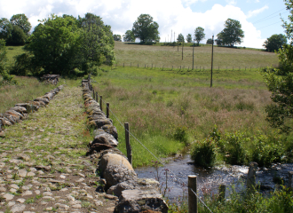
1 - Descend to the right on a large path which crosses a beech wood, follow the edge before following the stream. Cross the stream on a bridge of stones. Climb up opposite until the road.

2 - Follow the road until MONTREAL.
Pass between the houses and continue on the path which keeps to the left. Follow it. At the crossroads leave the left branch and continue until a crossroad passing in front of a farm.

3. Follow opposite on a large path between meadows. At the following fork continue right in the direction of an old cowshed with corrugated blue roof. The route of the ramble arrives at the point of the beech wood. Stay on this good path which turns to the left and reach a parking place.

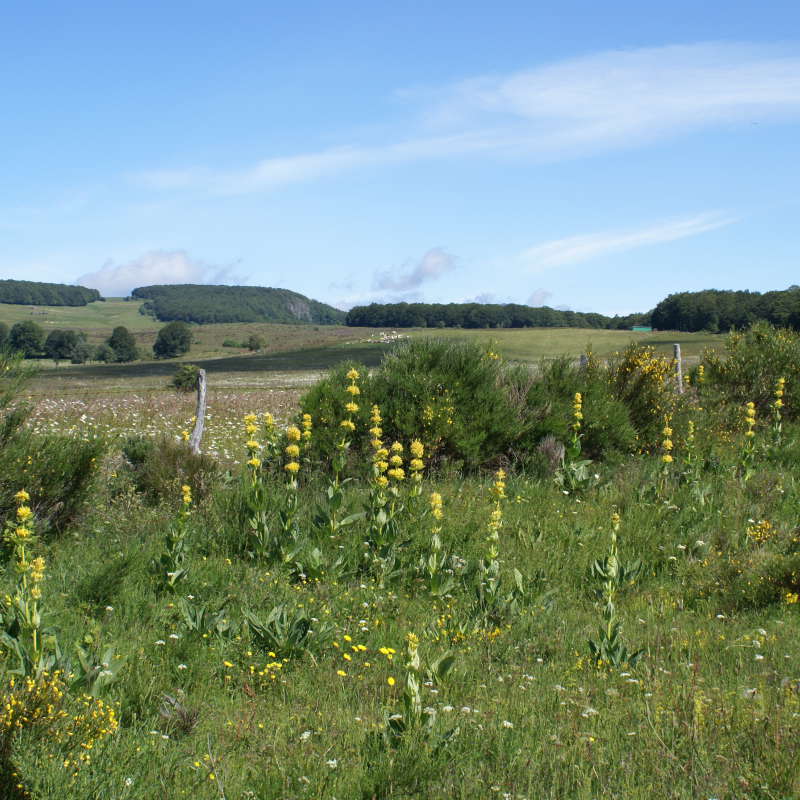
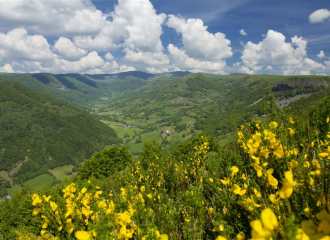
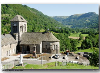
4 - The path passes near the ruins of the Buron du Louvatier. Beautiful view to the High Valley of Brezons and the Cantal mountains. Stay on the good path on the left until a parking place.

5 - Leave the track and take a grassy path in undergrowth. At the first crossroad go up to the right. By some bends join a large track.

6 - Follow to the left on the edge of the wood. Follow it until an opening in the wood. View to the Lebréjal and Aubrac plateau.

7 - At the following crossroad turn left on a path which again finds the wood. At the following crossroad go right then stay on this good track until the departure point.


Mountainbike: difficult level. Time: count 1 hr 30 minutes.
Difficult rise and uneven track between 1 and 2.
Difficult descent between 1 and 2.

Ouverture

From 01/05 to 31/10.

Subject to favorable snow and weather conditions.

Tarifs

Free of charge.

Contact et accès
Entrée du bois, au-dessus de Vigouroux
15230 Saint-Martin-sous-Vigouroux
Cantal (15)
Informations complémentaires
Équipements
  • Car park
Langues parlées
  • French
Animaux
  • Interdis : Traversées de pâturages et de propriétés privées, chiens interdits même tenus en laisse
À propos de la randonnée
  • Type : Boucle
  • Dénivelé positif : 257 m
  • Altitude Max. : 1350 m
  • Distance : 9 Km
  • Length : 3H
  • Niveau de difficulté : Moderé
  • Balisage : oui
  • Balisage : Jaune
  • Passages délicats : non

Ça peut vous intéresser

Extérieur du restaurant
Hôtel de la Poste St.Martin

Hôtel-Restaurant de la Poste

Saint-Martin-sous-Vigouroux
La chaussée vue de l'ouest
Office de tourisme de Pierrefort

Hike The Vigouroux Chaussée

Saint-Martin-sous-Vigouroux
Buron extérieur
Bureau de Tourisme de Pierrefort

Buron de la Combe de la Saure

Brezons
À proximité
La chaussée vue de l'ouest
Office de tourisme de Pierrefort
Cultural

Hike The Vigouroux Chaussée

Saint-Martin-sous-Vigouroux
Laur'Highland
Laur'Highland

Highland Cattle farm visit

Brezons
Bibliothèque de Saint-Martin-sous-Vigouroux
Pixabay
Cultural

Bibliothèque de Saint-Martin-sous-Vigouroux

Saint-Martin-sous-Vigouroux
The valley of Brezons
Hervé VIDAL
Volcano

The valley of Brezons

Brezons
Extérieur du restaurant
Hôtel de la Poste St.Martin
Traditional cooking

Hôtel-Restaurant de la Poste

Saint-Martin-sous-Vigouroux
L'église
Bureau de Tourisme de Pierrefort
Historic site and monument

Brezons Church

Brezons
Hôtel de l'extérieur
Hôtel de la Poste
Hotel - restaurant

Hôtel-Restaurant de la Poste

Saint-Martin-sous-Vigouroux
Eglise de Saint-Martin extérieur
B. Dussuelle
Historic site and monument

Saint-Martin-sous-Vigouroux’s Church

Saint-Martin-sous-Vigouroux
Dans le camping
Bureau de Tourisme de Pierrefort
Campsite

Camping municipal de Saint-Martin-sous-Vigouroux

Saint-Martin-sous-Vigouroux
Chaussée côté ouest
Bureau de Tourisme de Pierrefort
Historic site and monument

La Chaussée de Vigouroux

Saint-Martin-sous-Vigouroux
Sport
Hike The Fros Wood

Saint-Martin-sous-Vigouroux