Sport

Hiking loop from Lake of the Case d'Oche

Bernex

view of the Châteu d'Oche from the lac de la case
Description

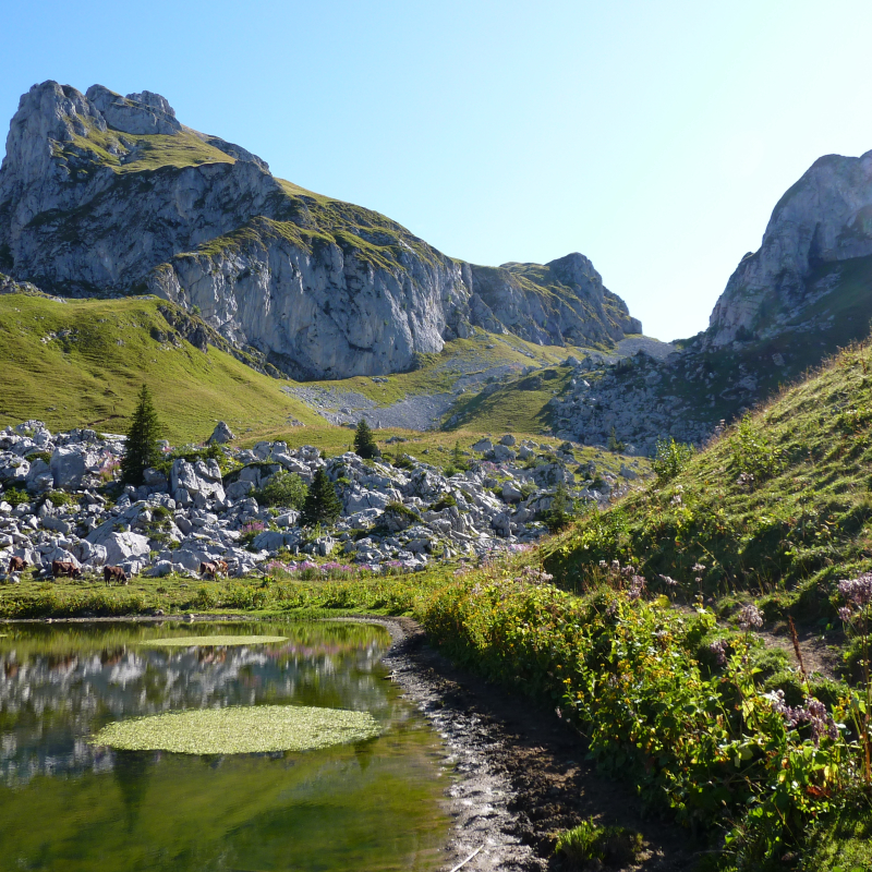
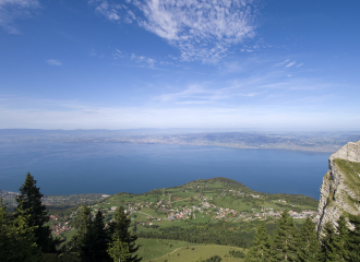
Starting from the Fétiuère car park in the commune of Bernex, this hike will take you to discover two mountain lakes.
You will first reach the Chalet d'Oche and its mountain pasture, and then the Lac de la Case, which is frequented by marmots. Keep your eyes and ears open, you may be lucky enough to spot one, or hear one whistling!
You will then take the Case d'Oche pass and its panorama of Mont Blanc and Lake Geneva before crossing the Darbon mountain pastures to reach the second lake of your walk: Lake Darbon, situated at an altitude of over 1800 m.
A final effort awaits you up to the Combe de Darbon and the pass of Portes d'Oche before starting your descent to the Lac de la Case.

Guidebook with maps/step-by-step

Start point: La Fétiuère car park
1/ From the car park, follow the direction "Lac de Darbon", you will pass the directional posts "Chalets d'Oche", "Alpage d'Oche" and "Lac de la Case".
2/ At "Lac de la Case", turn right towards "Lac de Darbon par Col de la Case d'Oche". You will pass by the "Col de la Case d'Oche" and the "Alpage de Darbon" to reach the lake.
3/ Once at the "Lac de Darbon", follow "La Fétiuère par Col de Pavis". You will pass by the following directional posts and signs: "Col de Pavis", "Combe de Darbon", "Les Portes d'Oche", and "Oche" until you reach the Lac de la Case again.
4/ From "Lac de la Case", follow "La Fétiuère". You take the same path as on the outward journey to reach your starting point.

Ouverture

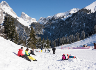
From 01/06 to 01/10.
Subject to favourable weather conditions and outside the snow period.

Tarifs

Free access.

Contact et accès
La Fétiuère
74500 Bernex
Haute-Savoie (74)
Informations complémentaires
Équipements
  • Parking nearby
Langues parlées
  • French
Animaux
  • Acceptés : Pets allowed on a lead only.
À propos de la randonnée
  • Type : Boucle
  • Dénivelé positif : 950 m
  • Dénivelé négatif : 950 m
  • Altitude Max. : 1940 m
  • Distance : 7.9 Km
  • Length : 5H15
  • Niveau de difficulté : Difficle
  • Balisage : oui
  • Balisage : Departmental markings called P.D.I.P.R. on beige metal panel and green writing

Ça peut vous intéresser

Restaurant La Fétiuère
M.Birraux

Restaurant La Fétiuère

Bernex
À proximité
Panorama of Pic des Mémises
Viewpoint

Panorama of Pic des Mémises

Thollon-les-Mémises
Bernex Station
Nicolas Blandin
Cross-country skiing

Bernex Dent d’Oche

Bernex
Regenerating Sophro walk on the Mont Bénand trail
Lydia Ferlin
Sporting activities

Regenerating Sophro walk on the Mont Bénand trail

Bernex
Façade de l'hôtel
Hôtel Le Cro Bidou
Hotel - restaurant

Cro Bidou Hotel

Saint-Paul-en-Chablais
Visit card
Edwige Buttay
Traditional cooking

L’Ormeau

Bernex
La Dent d'Oche
Mountain

La Dent d’Oche

Bernex
Indianaventure's Hut
Unusual accommodation

Indianaventure’s Hut

Saint-Paul-en-Chablais
Vue été
Le Bois Joli
Hotel - restaurant

Hôtel Bois Joli

Saint-Paul-en-Chablais
Salle de restaurant
Le Bois Joli
Traditional cooking

La Table D’Oche

Saint-Paul-en-Chablais
Take off from the Lavanchy

Take off from the Lavanchy

Thollon-les-Mémises
Vue sur le Leman
OT Thollon les Memises
1 New winter sports resort

Thollon-les-Memises

Thollon-les-Mémises
La yourte Indianaventures
Unusual accommodation

La yourte Indianaventures

Saint-Paul-en-Chablais
Sport
Hiking loop from Lake of the Case d'Oche

Bernex